
Written by John Feeney •
Photographed by Dana Smillie
 daring “green” experiment closely linked to Cairo’s past is blossoming in an unlikely spot—next to the city’s ancient eastern ramparts, on the site of a vast, almost equally ancient rubbish dump. For half a millennium, residents had tossed and hauled household garbage and building debris “over the wall,” creating a hilly landfill that rose as high as 40 meters (130') in the medieval heart of Cairo. Today, the site has been turned into a park modeled on the traditional Islamic garden, offering peace and quiet, and a view like no other.
The $30-million park project was spearheaded by the Aga Khan, whose family ties to Cairo date back to its founding by the Fatimids in 969. A thousand years later, in November 1984, as part of his interest in inviting local residents to contribute to the modernization of the Muslim world, the Aga Khan called a conference entitled “The Expanding Metropolis: Coping with the Urban Growth of Cairo” to address the city’s rapid population growth, the decline in the quality of its housing and associated problems.
When the meeting concluded, the Aga Khan decided to give a park to the city as a substantive contribution. He had a vision of providing Cairo with a large, open public area with trees, flowers and running water, in the manner of a traditional Islamic garden, “which would enhance the life of local communities” and also serve as a case study for a variety of modern urban development challenges. A park, he thought, would be an ideal gift, if only enough space could be found in this teeming city of 17 million souls where, according to one report, the amount of green space per resident was only about 350 square centimeters—the area of a man’s footprint.
By comparison, densely populated Miami has about 14 square meters of park per resident (150 square feet, or 400 times as much as Cairo)—and Cairo has no beaches.
A short time later, a most unlikely large, open space was suggested for the park: a 30-hectare (74-acre) desert area called al-Darassa, just outside the walls that enclosed Fatimid Cairo. A more desolate location—though occupied by a police horse stables—could hardly be imagined. Since no other land was available, the site was selected, and a bold plan was drawn up to lay out a lush green park with trees, pavilions and running water atop centuries of accumulated debris. It was a most derelict spot, but also a most historic one. Overlooking al-Darassa to the south stood the 11th-century Citadel, built by Salah al-Din Yusuf ibn Ayyub (Saladin), whose Ayyubid dynasty supplanted the Fatimids. To the west lay the 12th-century Ayyubid city, a densely packed area of crowded tenements, domes, minarets and mosques forming one of the richest treasure houses of Islamic architecture in the world. To the east sprawled the vast 15th-century Mamluk City of the Dead, with its ornate mausolea.
About 1500 meters (1 mi) from al-Darassa stood one of the oldest universities in the world, Al-Azhar, “the most blooming,” founded by the Aga Khan’s ancestors a dozen years after they began building Cairo. The new public area was named Al-Azhar Park, after the university.
But there was a problem. While the Cairo police horses could be moved to greener pastures with relative ease, three giant water reservoirs—each 80 meters (260') in diameter and 14 meters (46') deep—were slated to be installed in al-Darassa to provide much-needed drinking water for Greater Cairo. Undaunted, the planners decided to lay out the new park over the covers of the new water reservoirs, which thus had to be completed before work on the new park could begin.
With the assistance of Sasaki Associates of Boston, developers created a new master plan before the reservoirs were completed in 1995. The park would be built on a grand scale, based on the traditional Islamic gardens of the past: There would be shaded takhtaboush sitting areas, Persian and Timurid elements in the park’s water channels and a bustan, or orchard.
In 1996, the police horses were sent packing and the Cairo Governorate released the site to the Aga Khan Trust for Culture (AKTC). The project grew to include rehabilitation of the Darb al-Ahmar district immediately to the west as well as the restoration of several important monuments on the skyline of the old city: the 14th-century Um Sultan Shaaban Mosque and the Khayrbek Complex, which includes a 13th-century palace, a mosque and an Ottoman-era house. A school and 19 residences were also embraced in the project, and parallel social-development schemes involved a housing-credit plan and a microfinance program that gave local residents opportunities to restore their own houses and start small businesses. The trust had done similar projects in Hunza in Pakistan, in Samarkand and in Zanzibar, but this was its biggest and most complex undertaking ever.
In 1997, a team of Egyptian, French, Italian and American architects, engineers and landscape and horticultural specialists started work on the park. A fleet of earth-moving machines began the job of carting away 500 years of rubble —tens of thousands of truckloads amounting to more than 1.5 million cubic meters (1.96 million cu yd)—more than half the volume of the Great Pyramid. Then the excavators made a most unexpected discovery. On the west flank of al-Darassa, under rubbish mounds 30 meters (100') deep, they uncovered a totally buried section of the 12th-century Ayyubid wall built to protect Cairo, complete with its gates, towers, interior chambers, passageways and galleries. The AKTC called the find “one of the most important archeological discoveries of the past decades” relating to medieval Egypt. Plans were changed to incorporate the newly discovered wall into a broader project: It would be restored and used to both set off and link the new park and the old Ayyubid city.
Water, of course, was a key aspect of the project. The builders of the big Mughal gardens of India which, like the new Al-Azhar Park, covered whole hillsides, had paid careful attention to this. Luckily, a large-diameter water pipeline passed nearby that carried water from the Nile to an agricultural area, and a new spur was built to the park site. Agricultural soil and sand were trucked in.
At the same time, stonecutters working in a quarry in the nearby Moqattam Hills (where the casing of the Giza Pyramids had also been quarried) began carving out the thousands of limestone blocks required to build the park’s pavilions. Marble to line the waterways and fountains came from a quarry near Suez, more was brought from Carrara, Italy, and some specially colored marble came from as far away as India.
Meanwhile, horticulturalists took special steps to make the barren site bloom. Experiments to determine the best plant varieties to use in the park continued for five years at the American University in Cairo’s desert agricultural research center. Special nurseries were established to propagate some two million plants, and more than 665,000 plants—trees, shrubs, grass, climbers, succulents and ground cover—were established.
By 2004, 20 years after the Aga Khan had broached the idea, Al-Azhar Park was ready to receive its first visitors. It offered what many of the thousands of Cairenes who flocked there had only dreamed of—or perhaps read about in Castilian envoy Ruy Gonzáles de Clavijo’s account of his visit to Tamerlane’s garden in Samarkand in 1403: There was a great garden with many shade trees and all kinds of fruit trees, with channels of water flowing amongst them.
The garden was so large, great numbers of people enjoyed themselves in the summer, with great delight, by the fountain and under the shade of the trees.
As in the Mughal gardens of India, visitors enter the park through an imposing arched pavilion where a dozen foaming jets of water shoot out of the marble-lined pavement before them.
To the left of the fountains, a broad, palm-lined avenue stretches south to a startling view of the Citadel and the Muhammad Ali Mosque. Shaded resting places on both sides of the walk provide refuge from the summer sun.
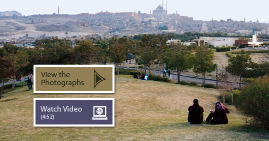
In the opposite direction, another stone-paved avenue leads to the green hills covering the three underground reservoirs. The top of the central one offers panoramic views of Cairo’s domes and minarets. From this spot, on a clear day, one can see as far as the Pyramids of Giza, across the Nile some 15 kilometers (9 mi) to the southwest.
The park’s northernmost hill is surmounted by a grove of date palms, a playground and a five-star restaurant designed by Egyptian architects to recall the Fatimid archways in nearby medieval Cairo. In the entrance court, flush with the floor, plays an eight-jet mosaic marble fountain of the traditional design used to cool the interiors of Cairo’s medieval houses. From there, a narrow, marble-channeled stream flows down the center of almost the entire park. It irrigates formal Islamic gardens of plants and flowers, rests awhile in quiet pools, then murmurs off down a sloping chute, called a chadar in the Mughal gardens, carved to make the water ripple and glisten in the sunlight. On through the park, the water irrigates the bustan of mango and orange trees and flows down to a tranquil lake.
In keeping with the Mughal architectural concept of setting a pavilion on a water surface, the Lakeside Café appears to float. Here, as in the five-star restaurant, water flows through the interior, cooling the tree-filled courtyards. There is another takhtaboush sitting area for visitors, who can look out across the lake to sweeping views of Cairo’s domes and minarets, hypnotically beautiful when silhouetted by a flaming sunset. To enhance an evening’s magic, lanterns set low to the ground light the park at night.
The construction of Al-Azhar Park out of a 500-year-old rubbish mound took more than 20 years, but the dream has been fulfilled. Cairo’s medieval midden now enhances the lives of Cairenes. Taking its cue from the 1000-year-old Al-Azhar University, “the most blooming,” the new park is meant to flower for another thousand years, offering a place of peace and contentment to generations of Cairenes.
 |
Filmmaker, photographer, writer, chef and friend, New Zealand–born John Feeney contributed articles and photographs, mostly from his beloved Egypt, to Aramco World and Saudi Aramco World for some 35 years until his death in 2006. |
 |
Dana Smillie is a photographer and video journalist based in Cairo, Egypt. She is represented by Polaris Images. |