 rom North Africa, Iberia and across the Middle East to Central Asia and northwestern China, these are qanats—subterranean aqueducts. Known by different names in different places, they all do the same thing: channel precious water from springs, lakes, streams and aquifers to low-lying fields in arid plains. Hand-dug and requiring routine, hands-on maintenance, they date back 3000 years, and many are still supplying farms and drinking water.
Growing food in arid regions has always been hard, risky work. Ever since humans first figured out how to cultivate crops more than 10,000 years ago, one of the biggest problems farmers have faced in lands with limited rainfall has been how to get enough water to their furrows.
In some lands, distant seasonal rains and mountain snowmelts flood rivers, and the runoff covers croplands. Such flooding happened along the Nile in Egypt for millennia, until that river was domesticated in modern times by the Aswan High Dam. Riverine flooding similarly fed Mesopotamian farmlands along the Tigris and Euphrates. In both regions, early engineers built elaborate systems of canals, channels and basins to regulate and conserve water.
Yet in these and other hot, dry lands, canals, channels and basins all face a common, elemental problem: evaporation. The blazing sun depletes surface water with merciless speed. So scarce and precious is the water that engineers devised a clever—if laborious—solution: shade the water in an underground tunnel sloped to allow gravity to move the water from source to thirsty farmland.
Just who dug the first qanats is uncertain. Although some researchers think they may have originated in the highlands of today’s Armenia, or perhaps in the mountains of Oman, the most widely accepted hypothesis points to the area commonly referred to today as Kurdistan—northwestern Iran as well as adjacent parts of Turkey and Iraq—in the early first millennium bce, where subterranean water systems have been found in the mountains. Ancient miners worked these mountains, too, and they would have known much about building tunnels. Geographer and early water systems researcher Dale Lightfoot of Oklahoma State University asserts that it was from here that the know-how for these irrigation systems spread both east and west to lands that today are parts of some 35 countries.
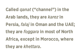 In Iran and throughout Central Asia today, this water-management system is often called by its original Persian name, karez (or kariz), which technically is an architectural word applied to the small feeder tunnels that flow into a larger subterranean aqueduct. The Arab countries, including Iraq, Syria, Jordan and Saudi Arabia, call them qanat (channel), and this Arabic word has become the most common generic term for this type of irrigation tunnel network. In Oman and the United Arab Emirates, the word is falaj, which means “division” or “arrangement.” In North African countries such as Algeria, Tunisia and Libya, foggara is the common name; in Morocco it is khettara. And at the eastern extremity of their diffusion, in northwest China, among Turkic Uighurs the name is again back to karez, a reflection of its Persian roots as an import via the Silk Roads.
In Iran, most karez stretch five to 10 kilometers (3-6 mi), but some go on for more than 70 kilometers (44 mi). Perhaps as many as 20,000 remain in use, totaling some 275,000 kilometers (171,000 mi). Many of them are in the vast Iranian Plateau, a geological feature extending some 2000 kilometers (1250 mi) from the Zagros Mountains in the west to the Indus River valley in the east with an average rainfall of only about 15 to 25 centimeters (6-10") each year. As late as the mid-20th century, the karez delivered up to three-quarters of Iran’s entire water supply.
In all places, the cross-section of a qanat tunnel is usually about one-and-one-half meters (5') tall and one meter wide—just enough to be dug and maintained by hand. The vertical shafts usually are spaced some 50 to 100 meters (164'-330')apart, and they connect to the water-bearing tunnel at depths of 10 to as much as 100 meters (32'-330').
Modern qanats are still constructed much like those of antiquity: Specialized diggers, in Arabic called muqannis (channelers), excavate first the vertical shafts, hauling dirt and rock up to the surface in buckets. If luck is with them, they will reach moisture at about 15 meters (50'), but they may have to dig much deeper. Eventually they begin work on the horizontal shafts, whose slope is determined by a surveyor.
Sometimes, when the soil quality is unstable, the muqannis may reinforce the shaft, tunnel or both with baked clay or stone. It is dangerous work. It is traditional for a muqanni to say a prayer before entering a shaft, and some will refuse to go underground on a day that is for any reason viewed as unlucky.
 ne of the earliest written records of qanat-building dates back to the eighth century bce, and it was found in Assyria. It recorded that Assyrian king Sargon ii, while on a military campaign in Persia, reported finding there an underground water system near Lake Urmia, in the northwest. Sargon’s son Sennacherib, ruling in the seventh century bce, adopted Persian techniques to build karez near his capital Nineveh and also at the city of Arbela.
In 525 bce, the Persian Achaemenids conquered Pharaonic Egypt. Not many years later, the Persian king, Darius i, asked the Carian Greek explorer Scylax of Caryanda to build a karez system 160 kilometers (100 mi) west from the Nile Valley through the Libyan Desert to Kharga Oasis, which was one of the major stops on the lucrative caravan trade route known as darb al-arba‘in (Forty Days Road). The late scholar H.E. Wulff noted in 1968 in Scientific American that “remnants of the qanat are still in operation” and, he speculated, this technology “may well have been partly responsible for the Egyptians’ friendliness to their conqueror and their bestowal of the title of Pharaoh on Darius.”
Later, trade and conquest served as a catalyst for the further expansion of qanat technology both east and west. Roman civil engineers employed qanats in conquered lands where their signature aqueduct technology proved unsuitable. For example, in Jordan, the so-called Gadara Aqueduct, which is a Roman structure unearthed about a decade ago, is not a true aqueduct, but rather a subterranean water tunnel—a qanat—and at 170 kilometers (105 mi), it is the longest such tunnel of antiquity. The Gadara system, also known as qanat firaun or “Pharaoh’s Qanat,” was constructed after a visit by the Roman Emperor Hadrian in about 130 ce, and it partly follows the course of an earlier Hellenistic tunnel. The Roman version appears to have been unfinished, although it was put into service in sections.
 n North Africa, the earliest qanats date from the second half of the first millennium bce. There, archeologists and other experts trace the migration of the technology from Egypt to the Fezzan region of southwest Libya, which was inhabited by the Garamantes, and from there, it spread eastward across the Sahara to present-day Algeria and Morocco.
In the oases of Algeria, qanats—which became known as foggaras—enabled the development of new north-south caravan routes that built trade relations with sub-Saharan Africa. Archeologist Andrew Wilson of Oxford University, who has studied the foggaras of the west-central Sahara, says the oases “are today the zones of most highly developed foggara use anywhere outside Iran.” Wilson notes that while traditional scholarship dates the establishment of the foggara as late as the 11th century ce, there may be “grounds for thinking it may go back to the seventh century if not earlier” based on “strong similarities, in construction and nomenclature,” between Algerian foggaras and those of the Garamantes in Libya.
Timimoun is a small oasis town in Algeria’s Gourara desert region, and it is known for its red ochre buildings as well as its substantial, still-operating foggara system that irrigates date palms and other crops. At the last formal count in 2001, the foggara here numbered about 250, but as local farmers increasingly turn to electrically pumped wells, the foggara are slowly going dry. The wells deplete the aquifer, and unlike foggara, wells can be drilled ever-deeper. This story is playing out all over Algeria, where United Nations water resource surveys have noted a decline from some 1400 active foggara in the recent past to some 900 now. While there have been recent efforts to rehabilitate some foggara that may date back to before Islam in the seventh century, the pressures on farmers to switch to more modern water-supply methods is unrelenting.
 he western expansion of Islam and Arab civilization in the seventh and eighth centuries ce, throughout North Africa and north across the Mediterranean into the Iberian Peninsula, resulted in the second major spread of qanat technology after the Garamantian era. Qanat construction was carried out in the eastern Mediterranean in Cyprus and westward in the Canary Islands. Geographer Paul Ward English of the University of Texas at Austin notes that qanats also spread to the New World, where they were built following Spanish conquests in Mexico at Parrás, Canyon Huasteca, Tecamenchalco and Tehuacán.
In the other direction, at the eastern extremity of their diffusion, English observes, the karez of Iran spread to Afghanistan, Silk Road oasis settlements of Central Asia and into western China, “although whether this diffusion occurred under the Achaemenids or some later Persian dynasty is uncertain.”
In Xinjiang, the oasis city of Turpan (or Turfan) has a venerable history as a major stop on the trade routes from the West. Surrounded by mountains yet lying below sea level, the city is built in one of the world’s deepest inland depressions—the Turpan Depression. This, it turns out, is an ideal setting for gravity-powered, underground water tunnels, fed from watershed runoff.
Summers in Turpan are scorching, and dry winds carry sand from the nearby Taklamakan Desert. Karez have provided water for residents and passing caravans alike here since the Western Han Dynasty more than 2000 years ago. Almost uniquely among all the world’s qanat-using areas, Turpan has actually experienced growth in these water systems since the 19th century.
In 1845, the famed Chinese official and scholar Lin Zexu, considered a role model for moral governance in China, was made a scapegoat for two successful British military incursions along the Chinese coast, and he was banished to distant Xinjiang. While living in the northwest, Lin became familiar with karez technology, and he promoted its spread beyond Turpan, in time winning support from the central government.
By 1944, the Turpan area was home to some 379 karez, and by 1952, there were 800 underground water systems in the depression. Their total combined length of 2500 kilometers (1555 mi) equaled that of the Grand Canal from Beijing to Hangzhou, the longest artificial waterway in the world. Today that total distance has doubled, and there are well over 1000 karez in the Turpan Depression.
From Iberia to China, qanats have made possible farming—and, indeed, civilization—in many arid lands. As Wulff concluded in 1968, “The qanat works of Iran were built on a scale that rivaled the great aqueducts of the Roman Empire. Whereas the Roman aqueducts now are only a historical curiosity,” qanat technology “is still in use after 3000 years and has continually been expanded.”
Although qanats in Iran and North Africa are declining, they still play significant roles there, as they do in northwest China, where they grow in length and number, which all says much about the timeless value of keeping precious water safely below ground, out of the sun.
 |
Robert W. Lebling (lebling@yahoo.com) is an American writer, editor and communication specialist who lives and works in Saudi Arabia. He is author of Legends of the Fire Spirits: Jinn and Genies from Arabia to Zanzibar (I.B. Tauris, 2010 & 2014), and he is co-author, with Donna Pepperdine, of Natural Remedies of Arabia (Stacey International, 2006). He is a regular contributor to Saudi Aramco World. |
 |
George Steinmetz (www.GeorgeSteinmetz.com) has been a regular contributor to National Geographic and GEO magazines for more than 25 years. He has won numerous awards for photography, including two first prizes from World Press Photo. |